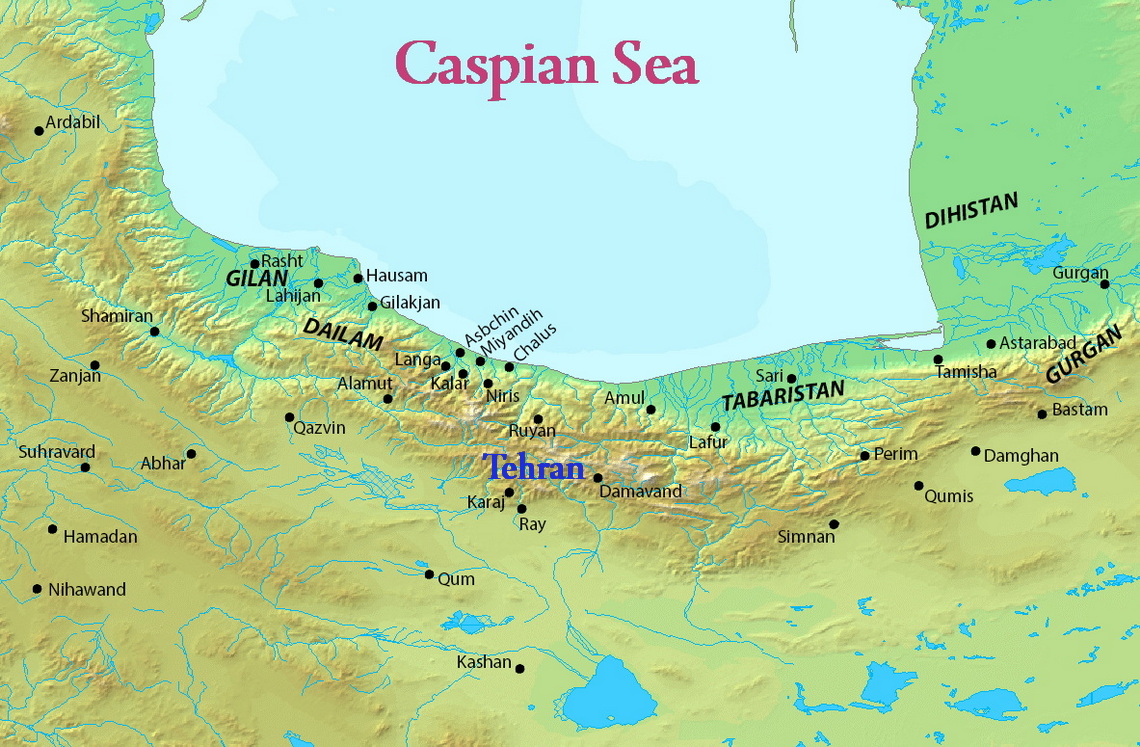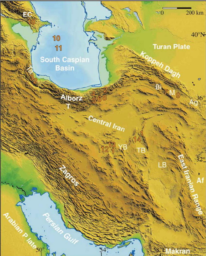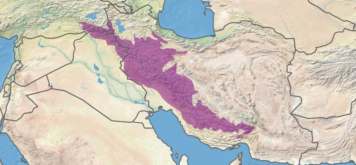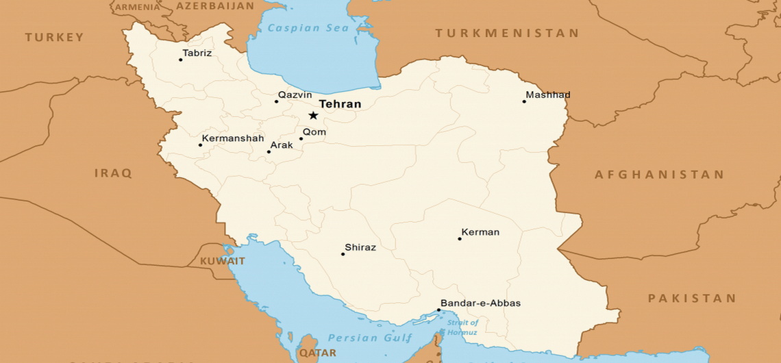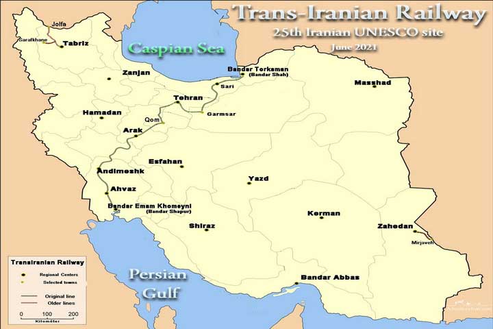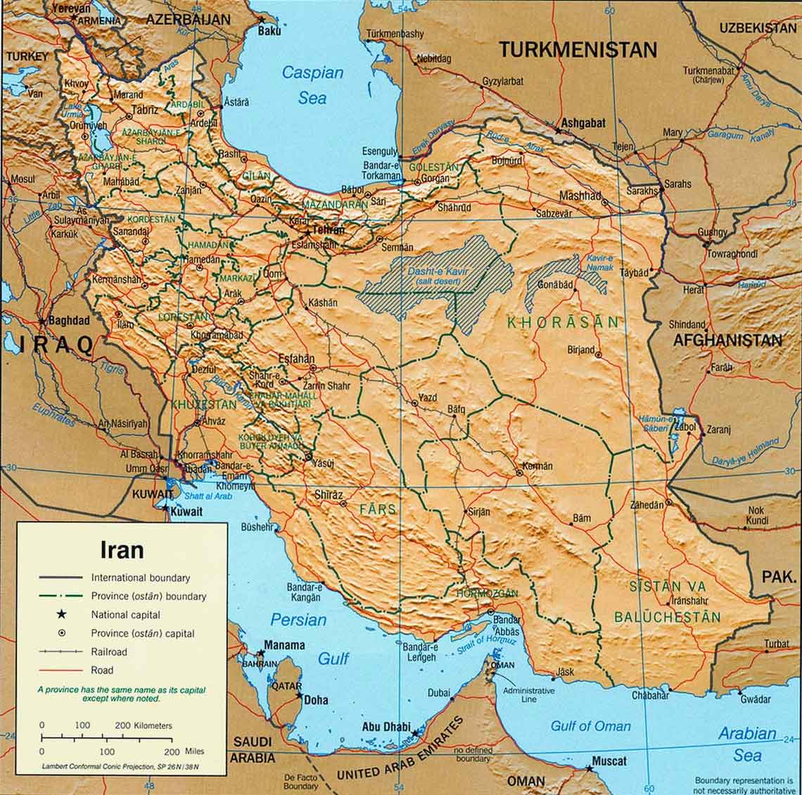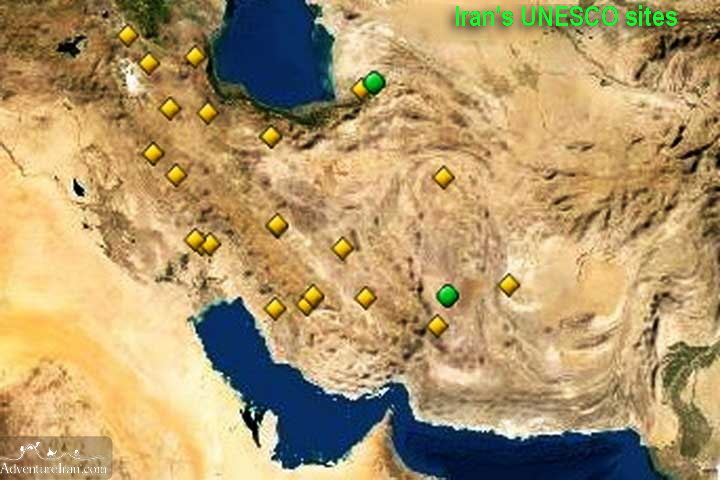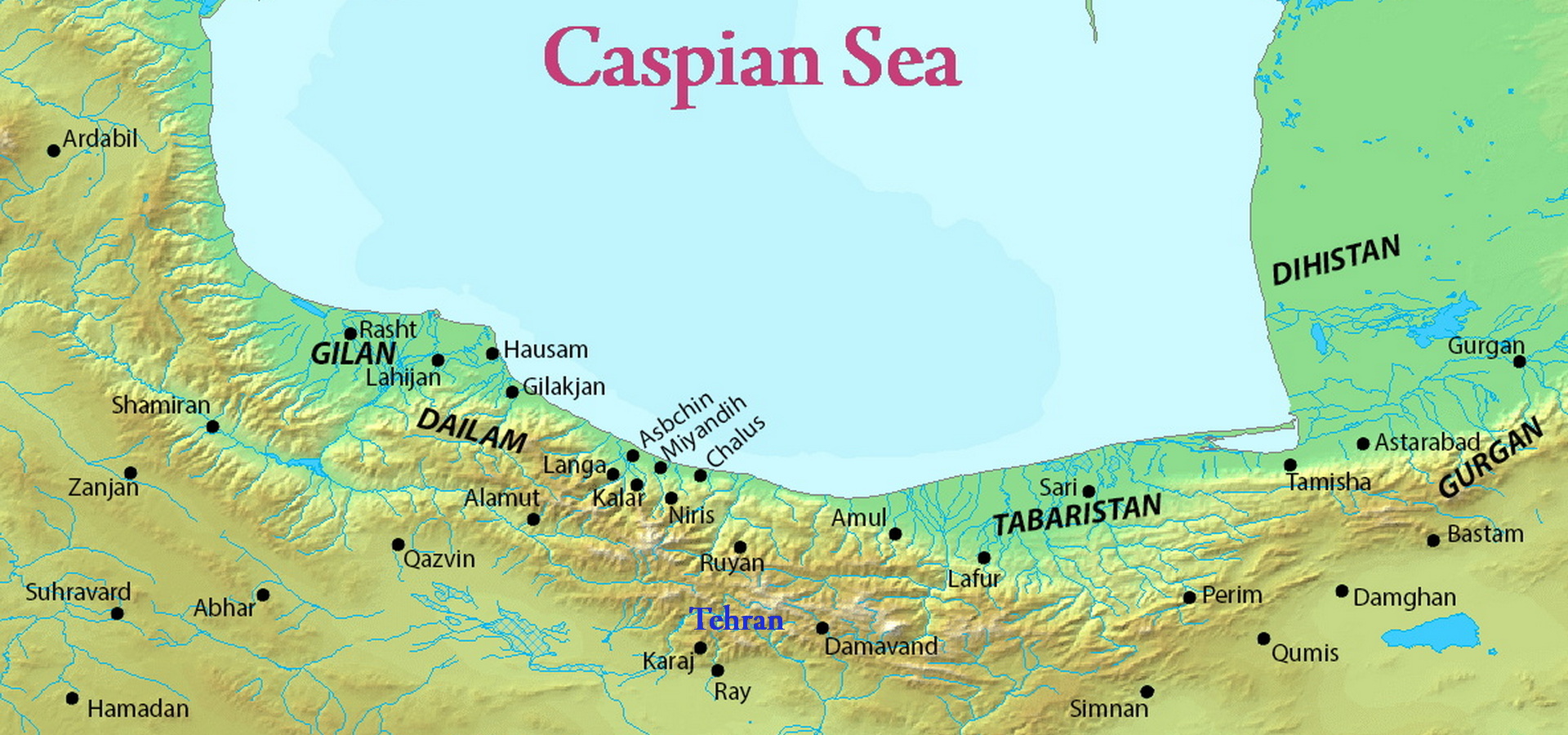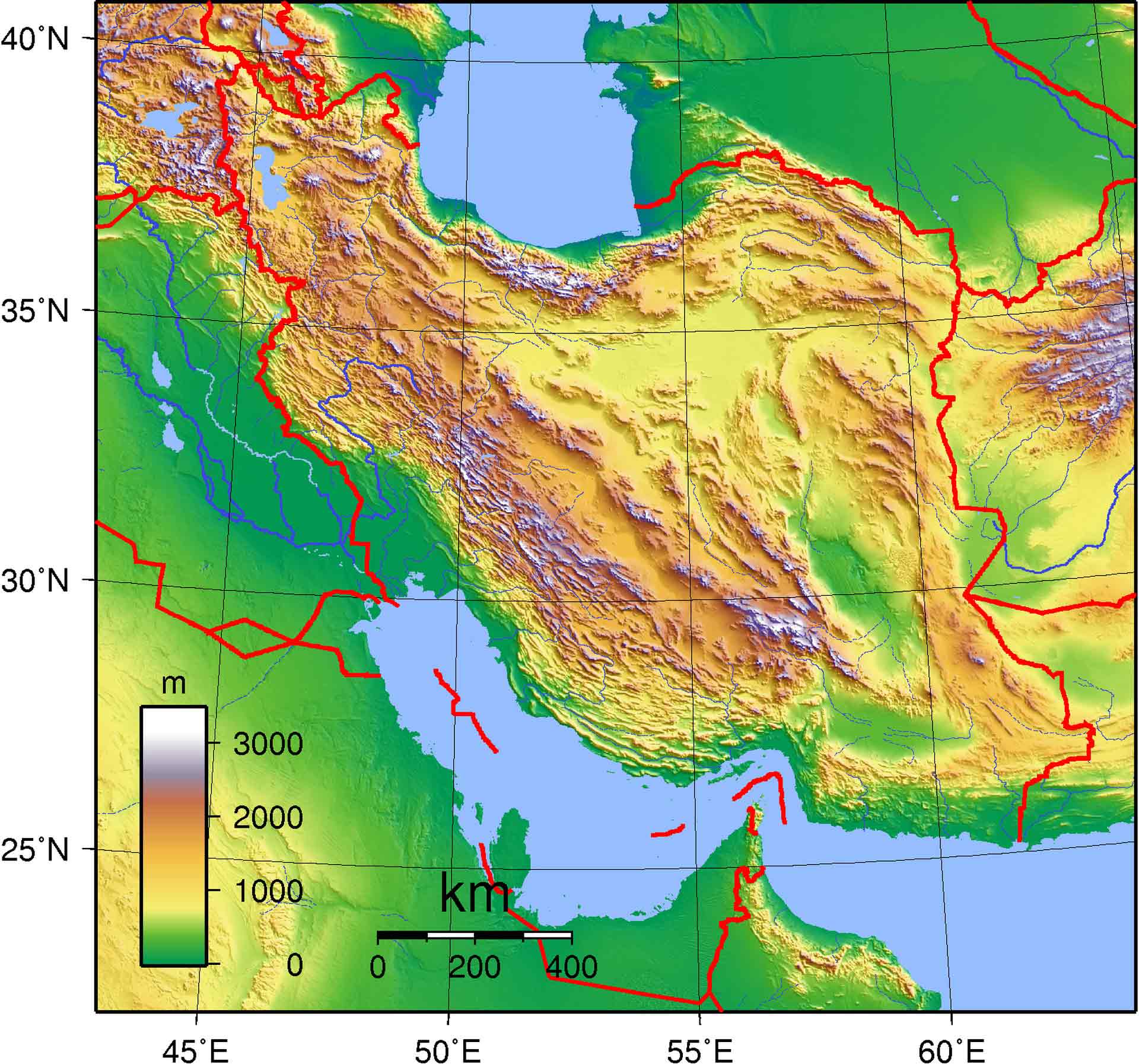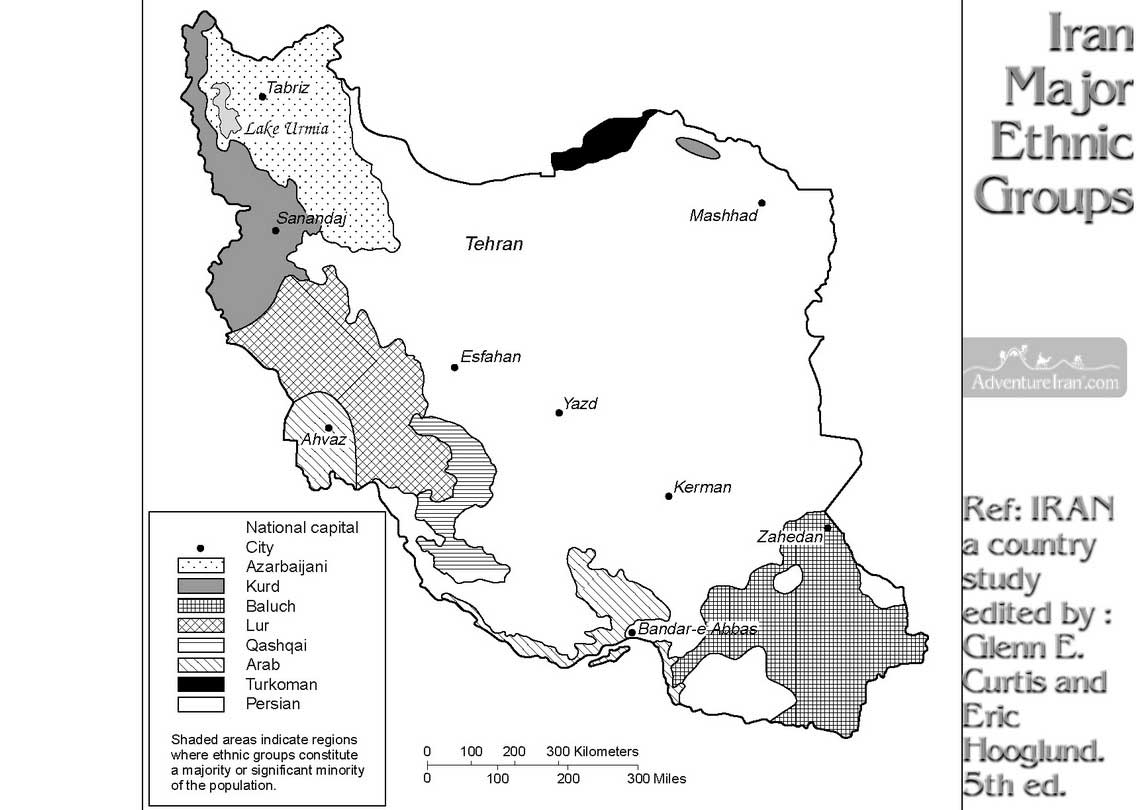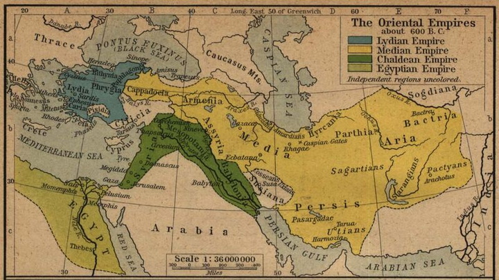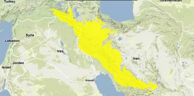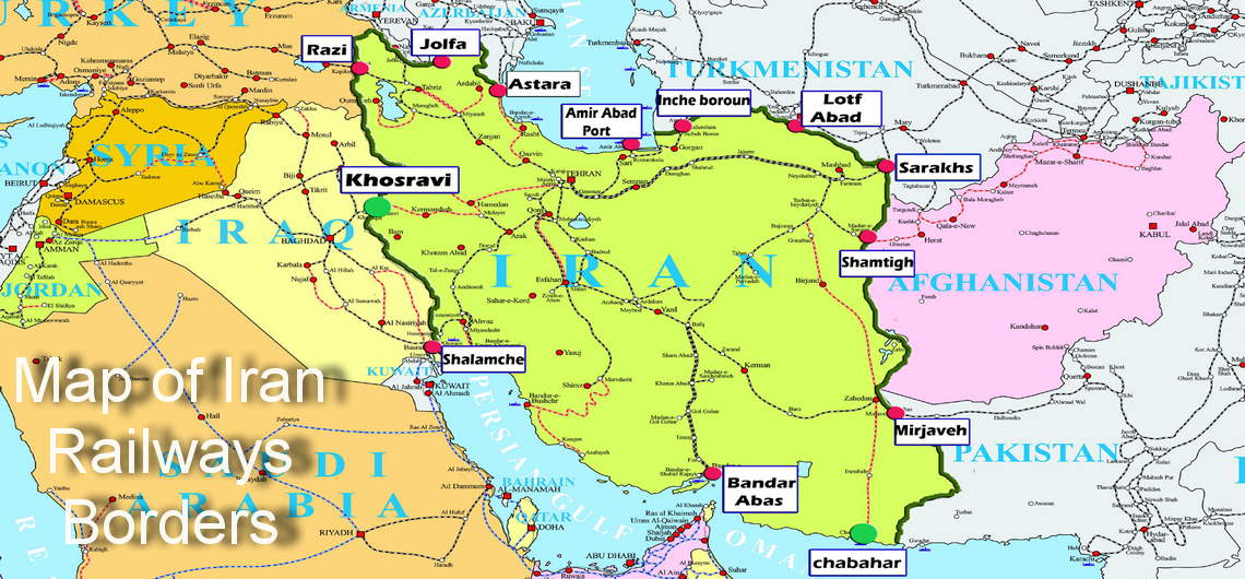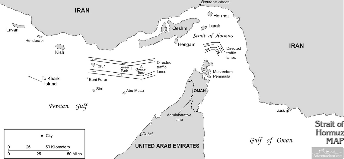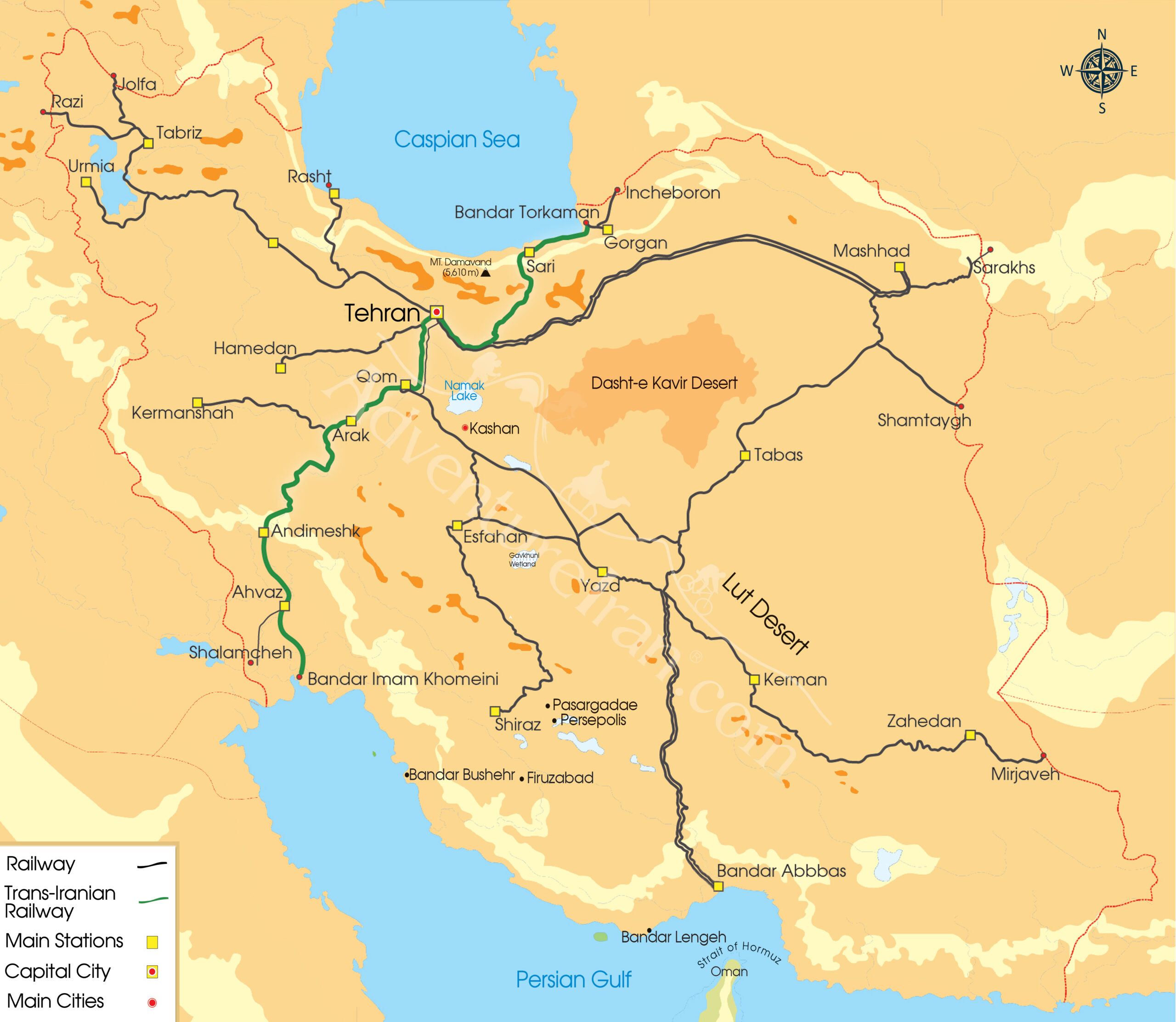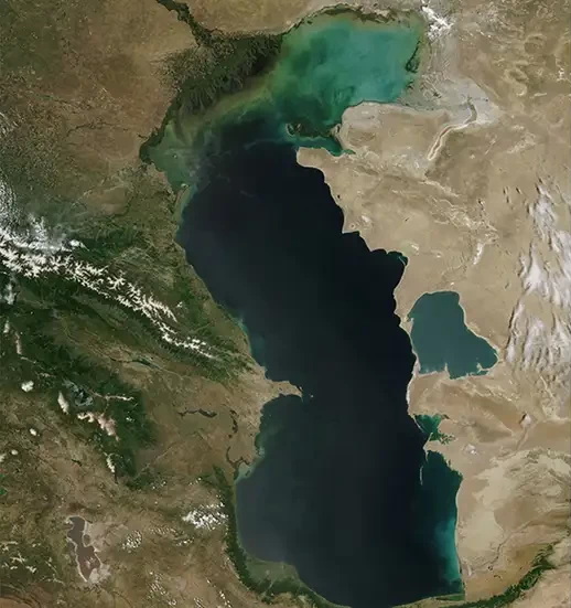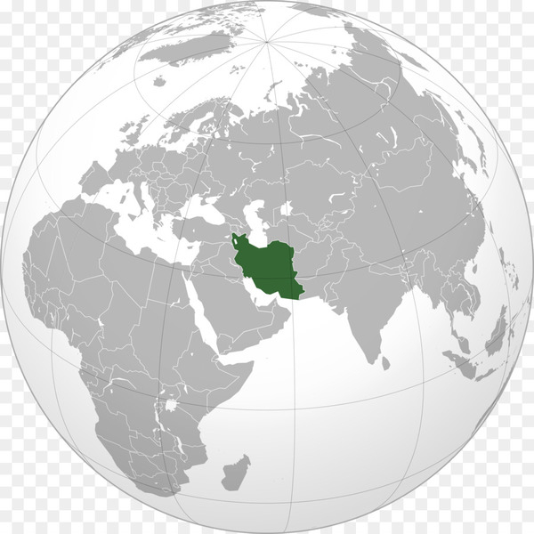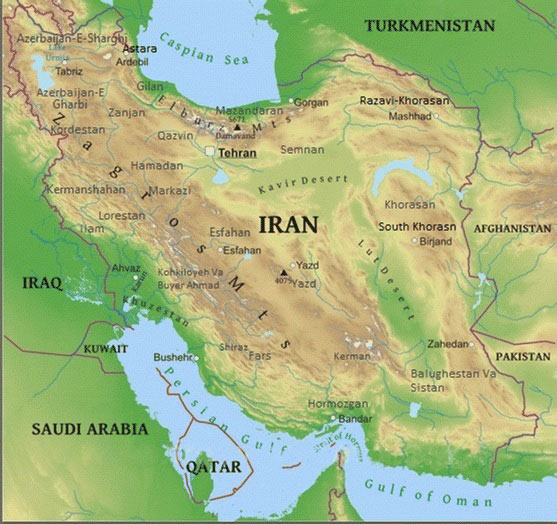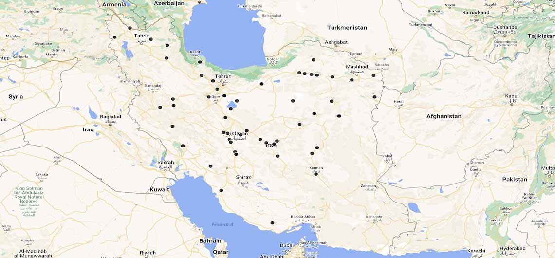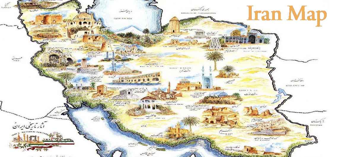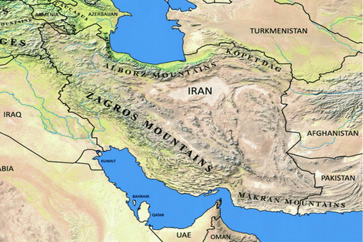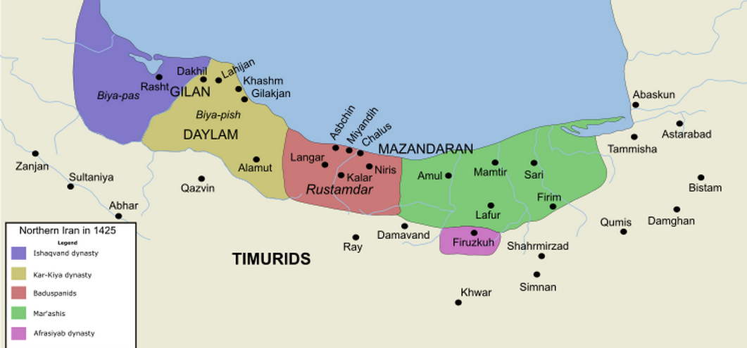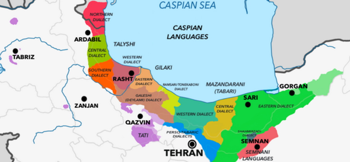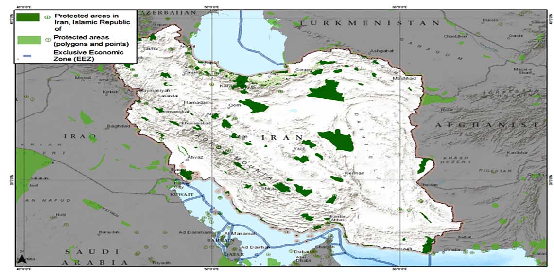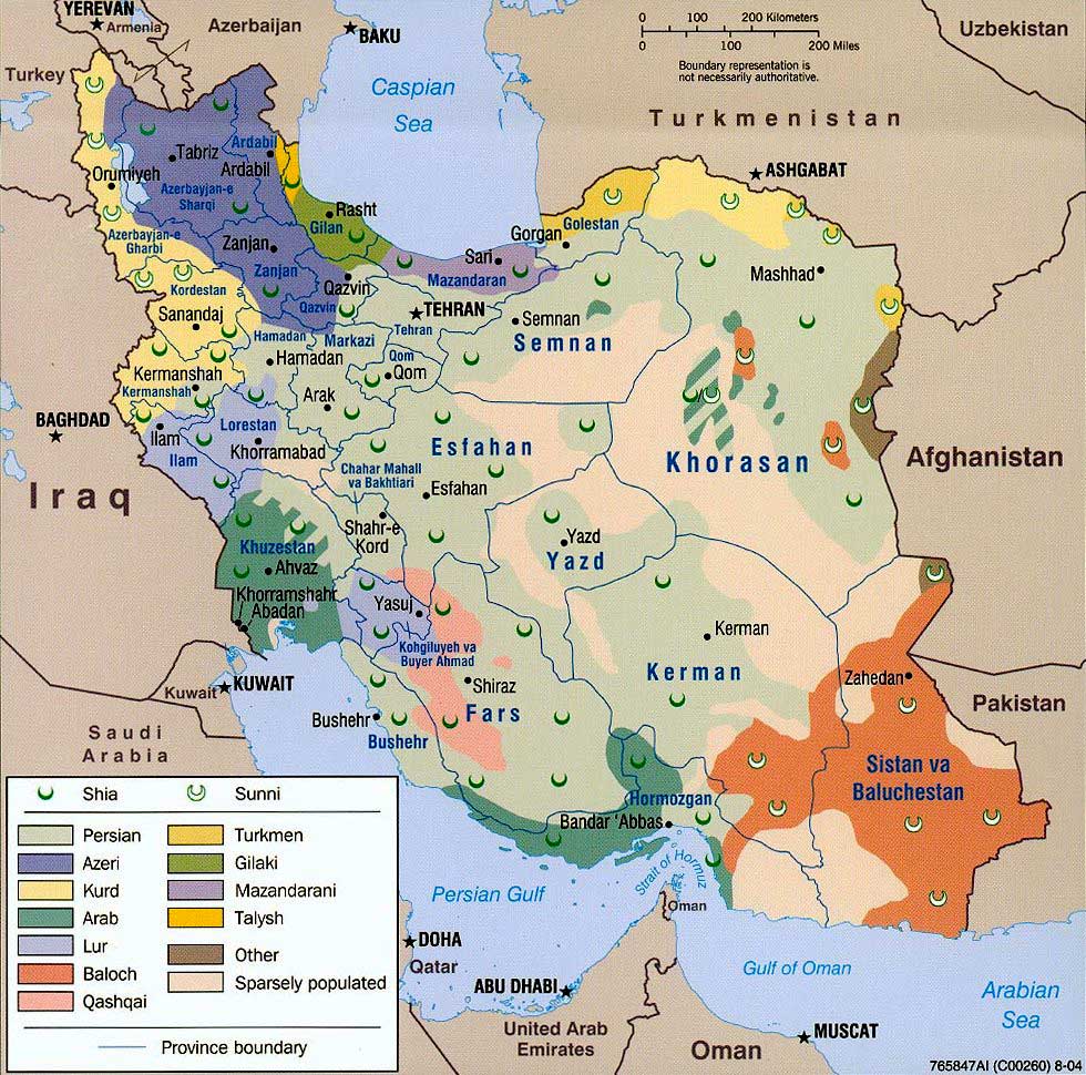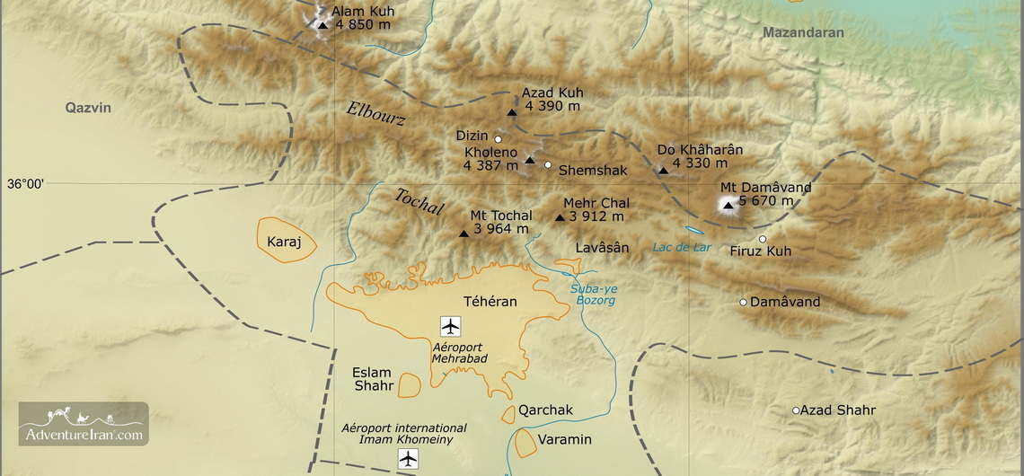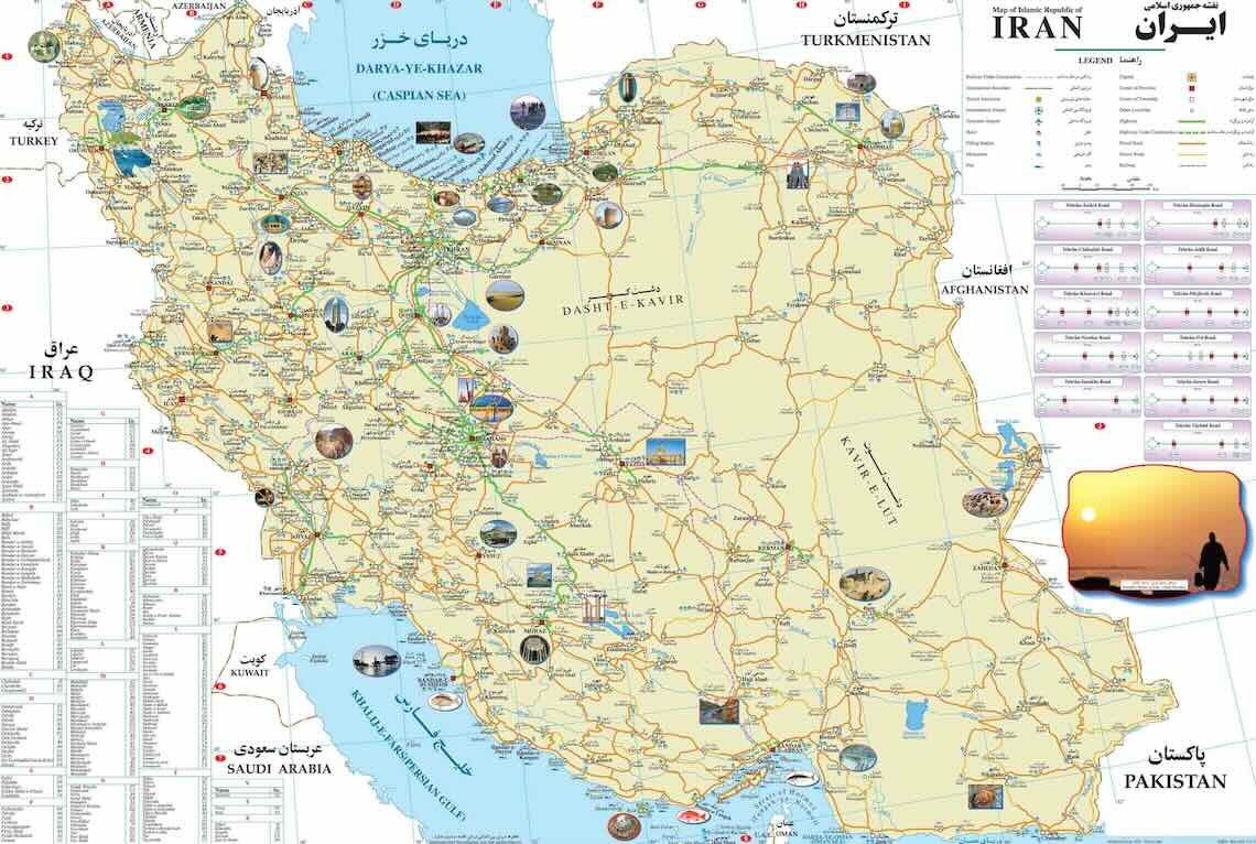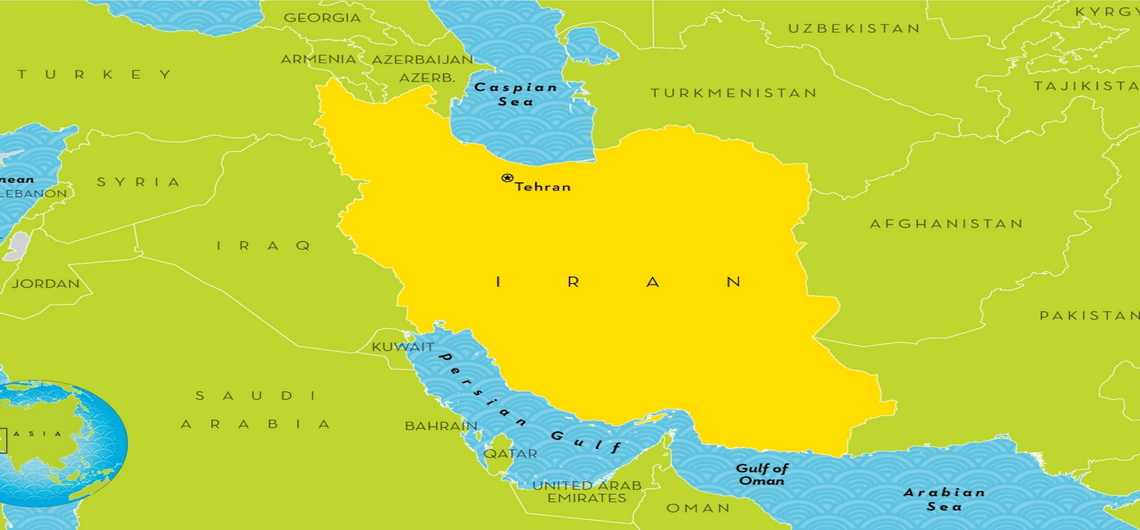
IRAN MAPS
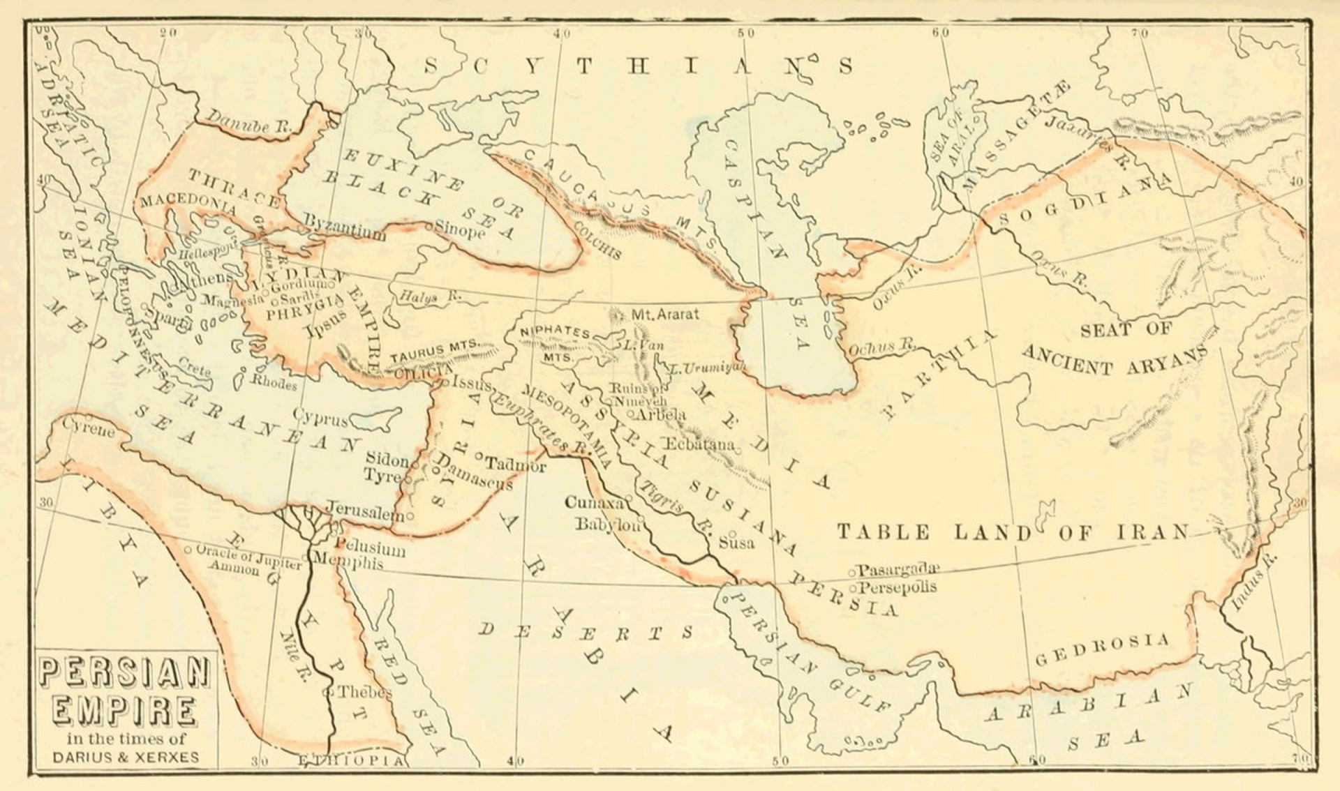
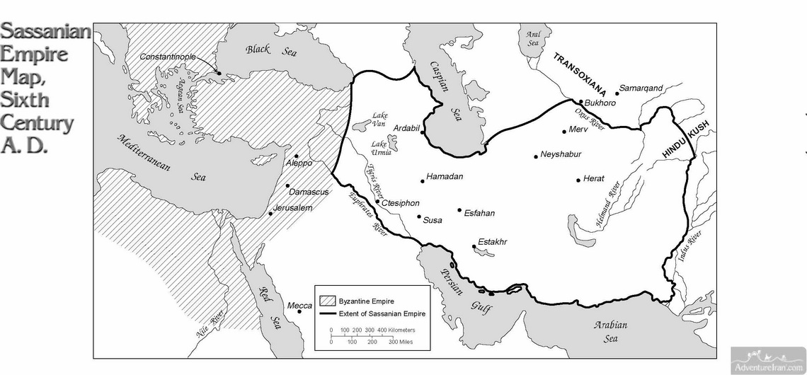
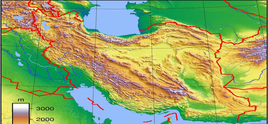
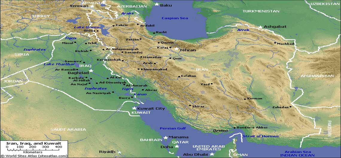
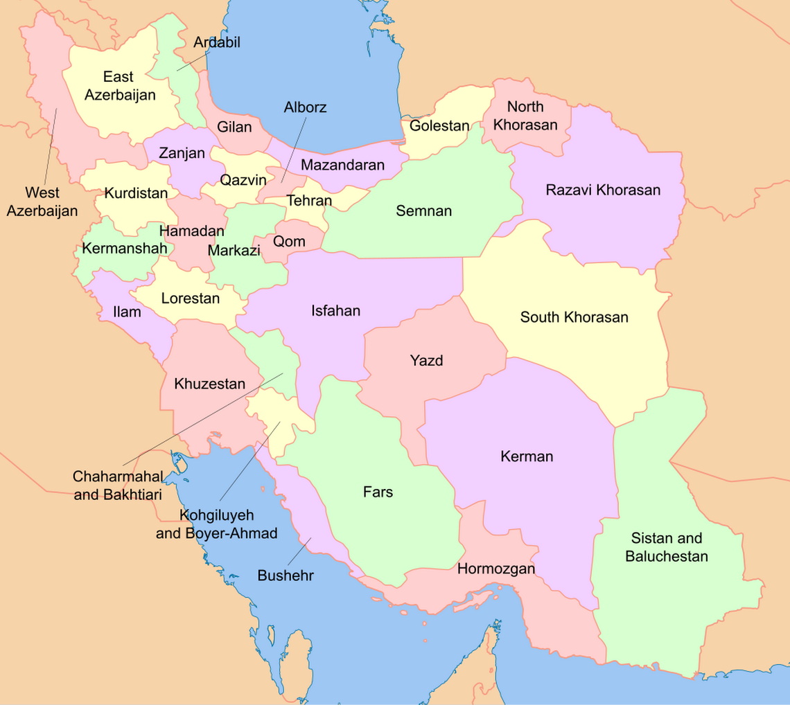
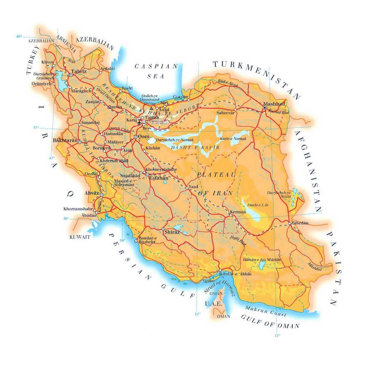
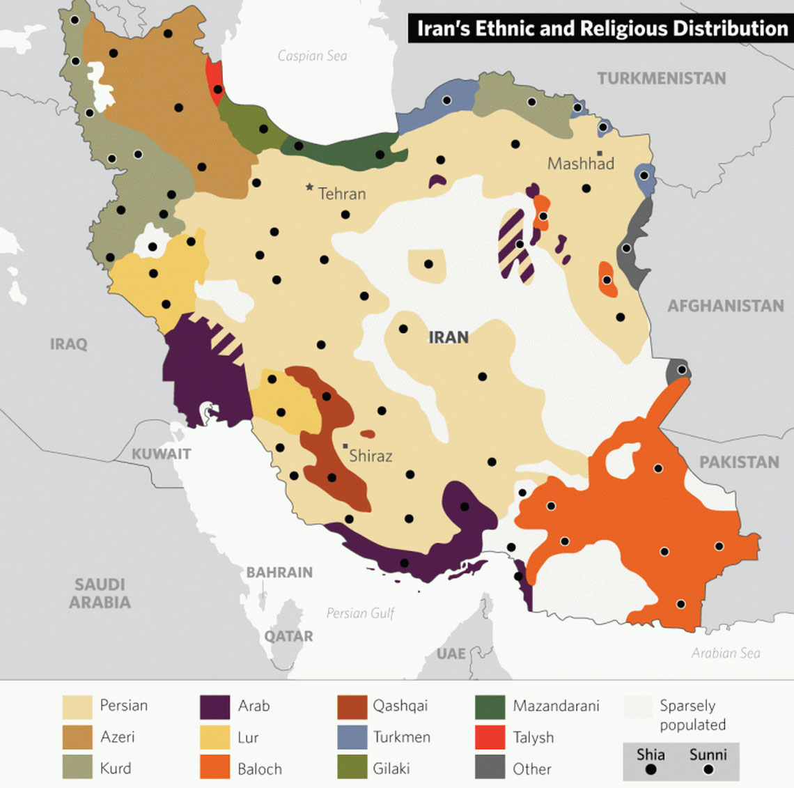
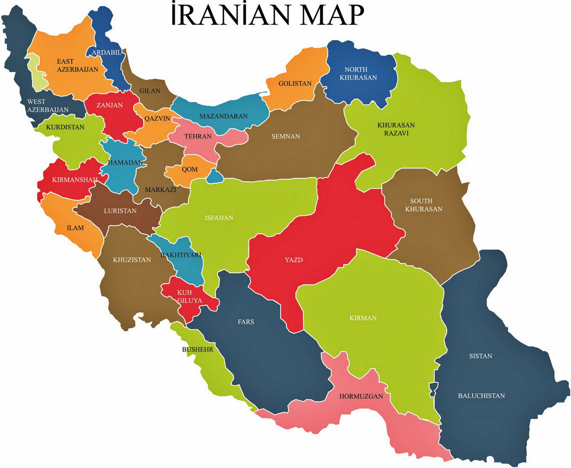
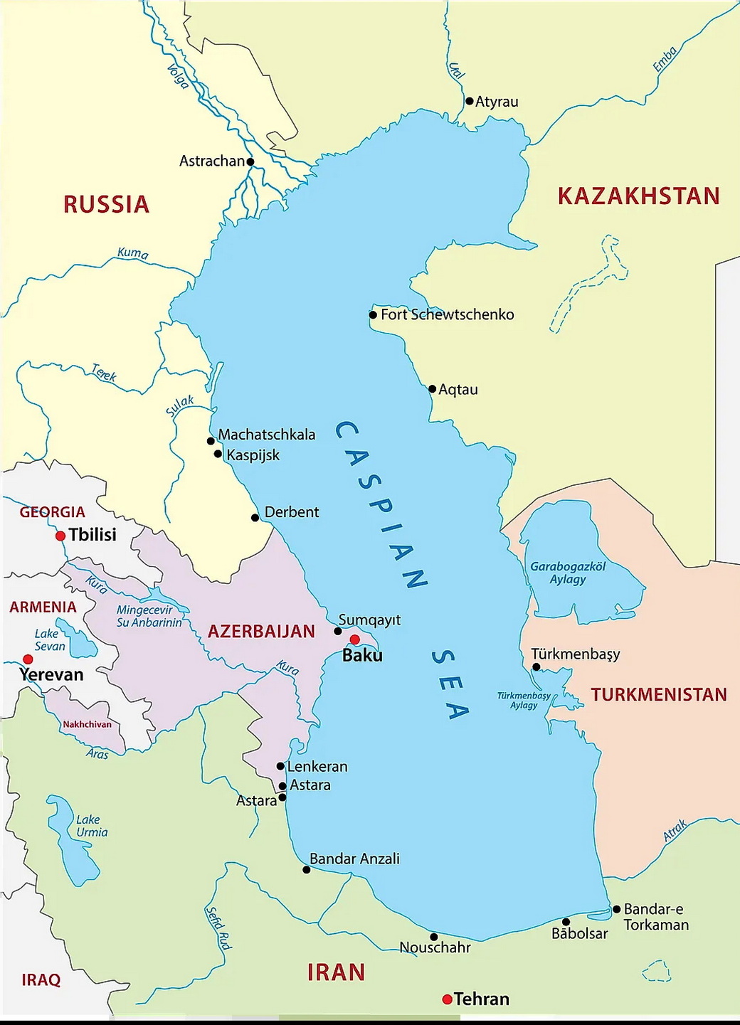
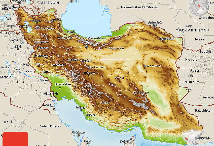
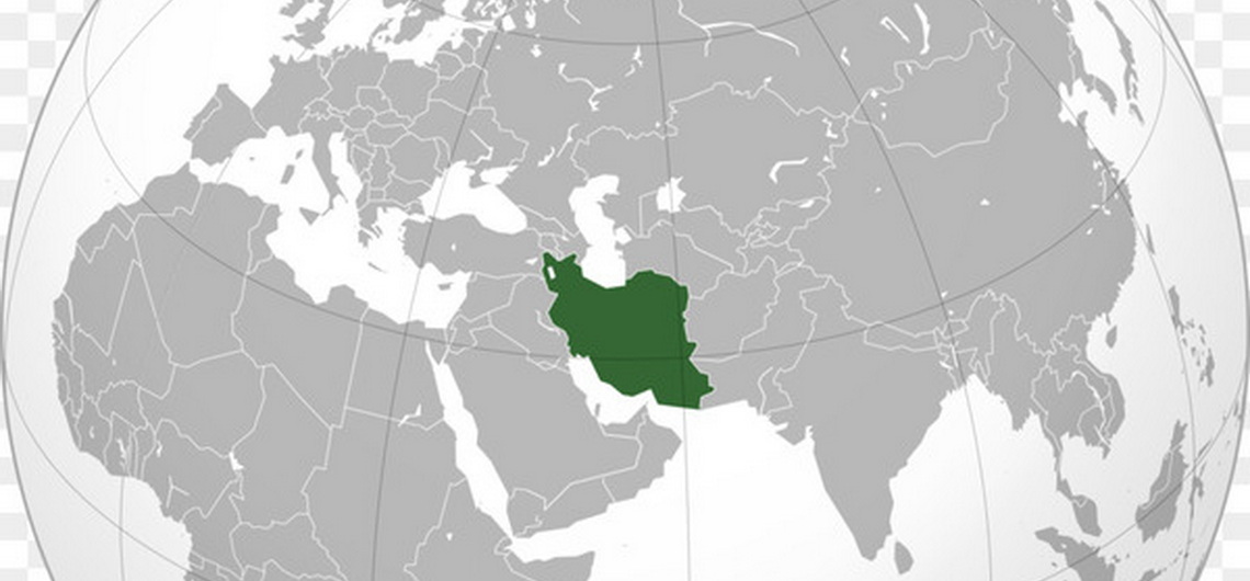
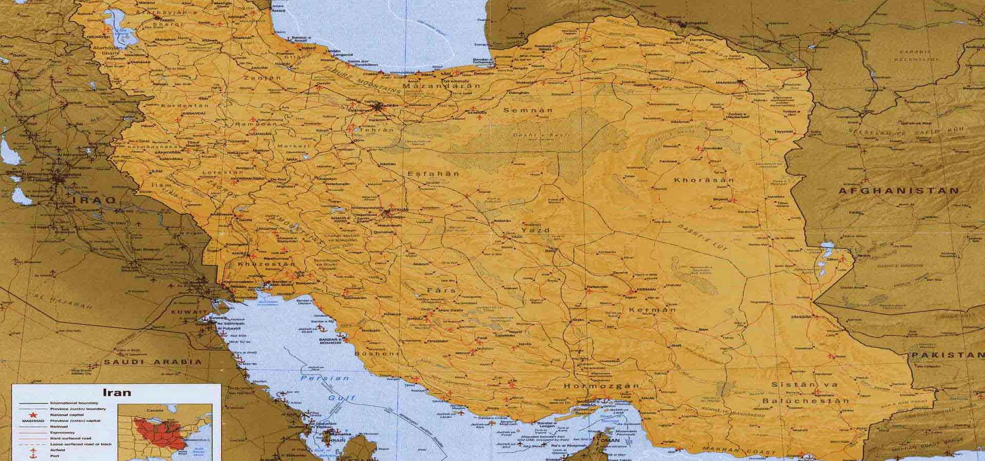
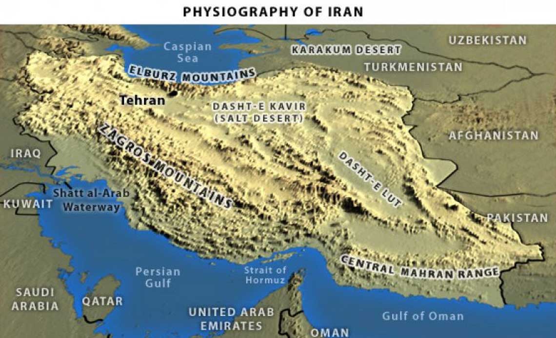
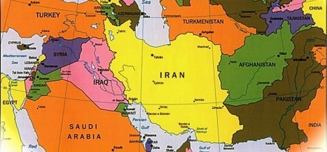
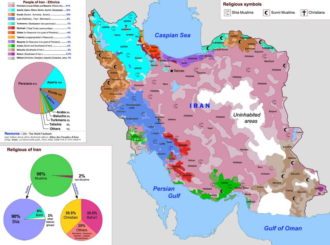
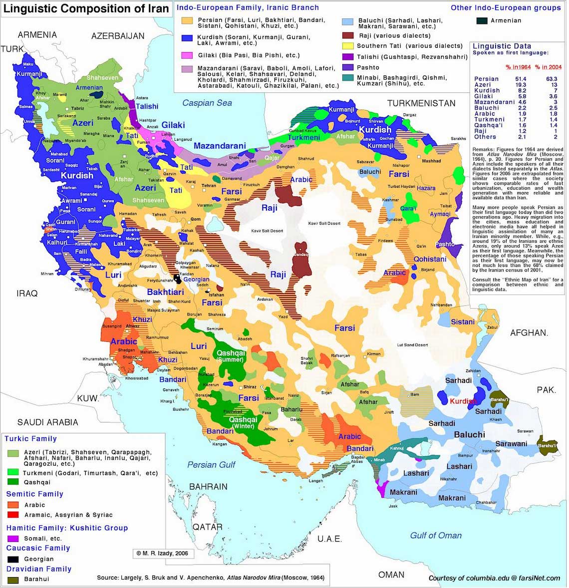
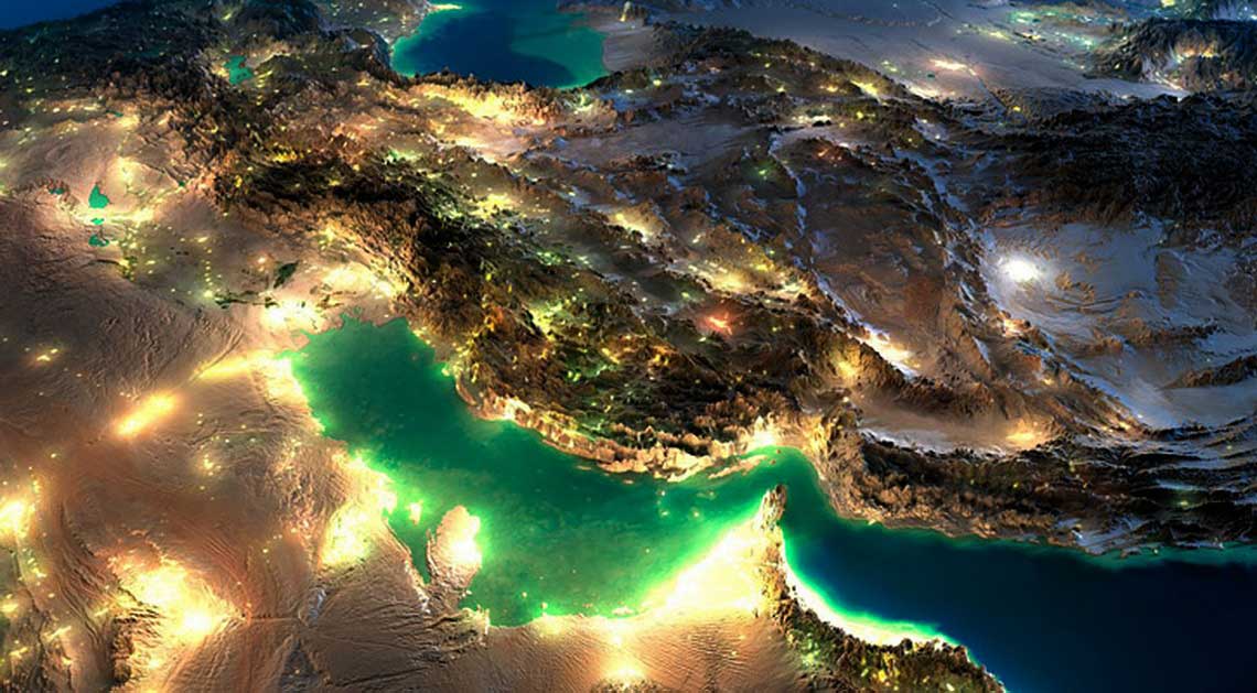
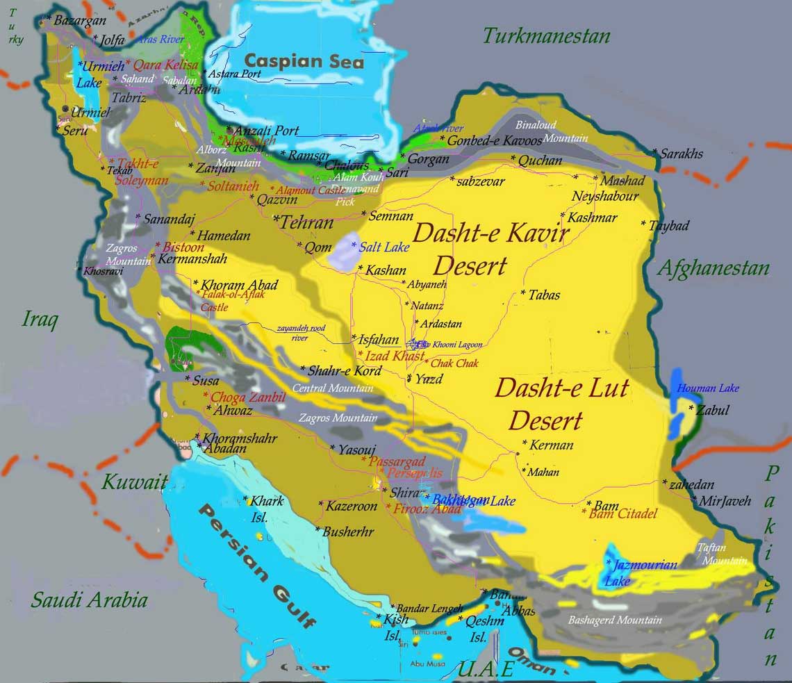
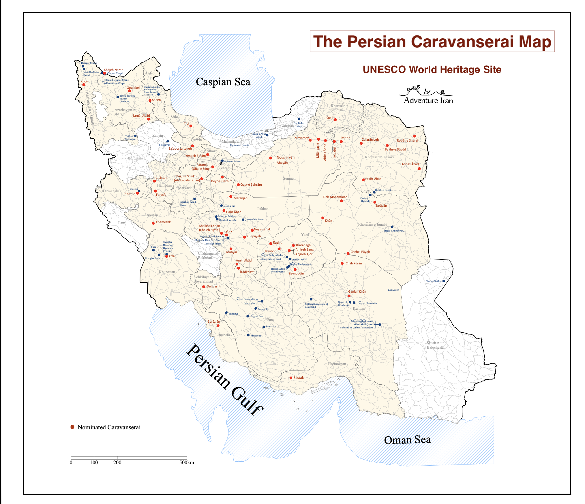
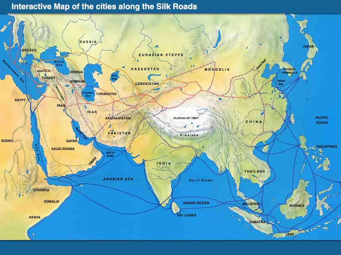
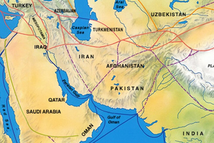
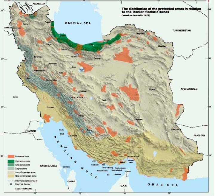
This part of the site is Iran Maps and it has been dedicated to representing different maps of Iran. Since maps are an essential part of a travelers’ equipment and also due to the lack of variety in Iran’s maps, we decided to dedicate a section to this important part of every journey which provides a variety of maps of Iran for different interests. There are includes of Persian Empire, Historical, Province, Topography, Elevation, Religion Map, Terrain, Iranway, Silk Road, Deserts, Mountains, Ethnic Diversity, National Pars, Protected Areas, Satellite, Iran in Middle East, Language Distribution, Caravanserai, Neighborhood Country, Persian Gulf Map, Caspian Sea and Historical Map of Iran.